LOGGING
THE CHILLY FOREST
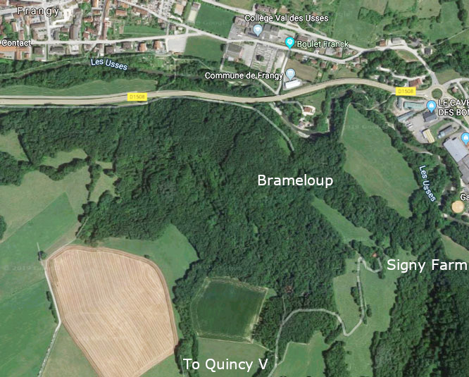
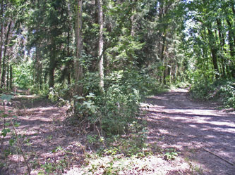
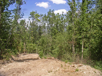
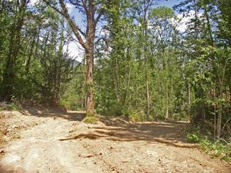
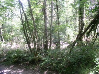
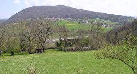
In early 2019, I was surprised to discover that logging had begun in the forest behind my chalet up the hill towards Quincy, with trees felled and piled up along the road, and some stacked as firewood. I knew that the forest department had made an inventory of forest resources there some years ago. Then in July 2019, I found that more trees had been cut and logging roads carved out of the forest to give access. The sign below indicated that the municipality of Chilly was managing its communal forest for continuing wood production.
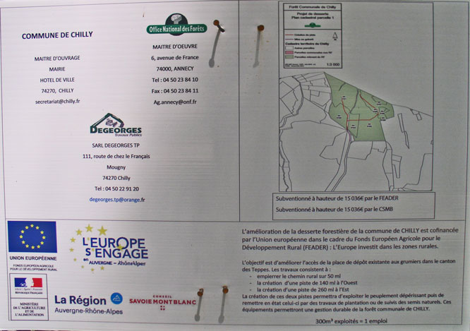
 Chilly forest plan; entrance to the Chilly communal forest (and down to my chalet) with newly graveled road
 The logging roads are quite large and follow the red lines on the map
 .
.  .
. 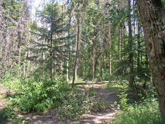
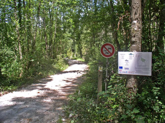
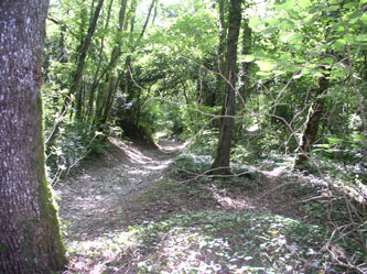
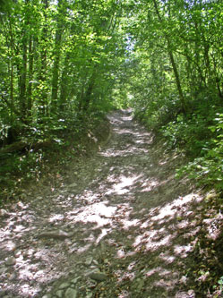
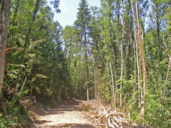
The rural path (chemin rural) going up behind my chalet to the village of Quincy, part of the Chilly municipality; forest clearing, mostly planted conifers
 .
.  .
. 
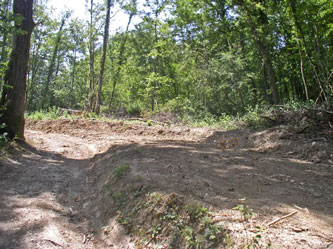
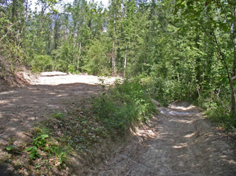
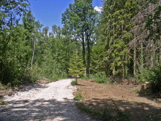
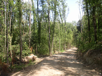
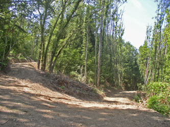
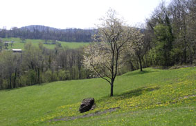
The old path down to my chalet (left) and new logging road on the right; road up to Quincy lined with logs; access road branches off to Signy Farm with logging to the left
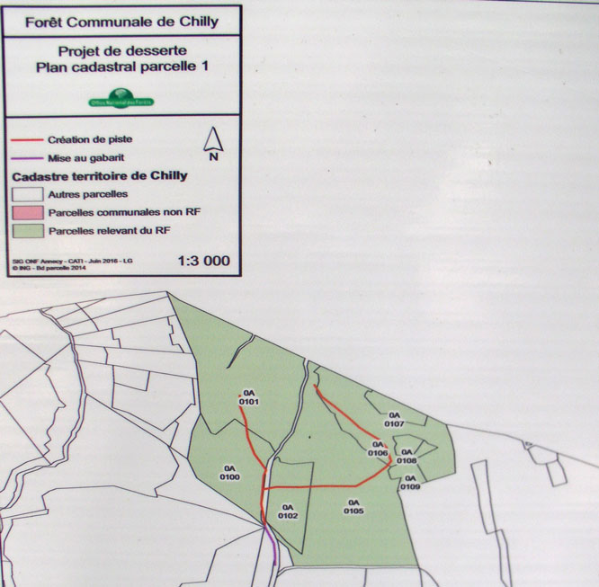
Map of Chilly municipal forest showing the new logging roads in red to the west and east
 .
.  .
. 
Logging road going off to the west
 .
.  .
. 
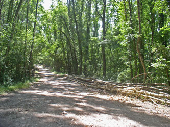
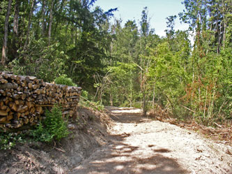
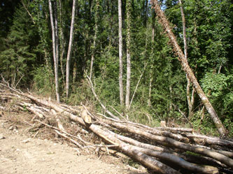
Firewood stacked on road to the west; the main road was widened, the forest logged, and new gravel laid on the upper part
 .
.  .
. 
Logging road to the east, towards Signy Farm
 .
.  .
. 
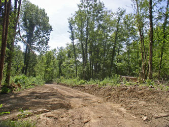
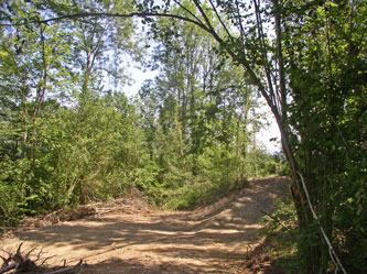
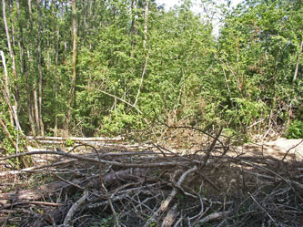
Logging road to the east, with tree trunks and debris, then turning then back down to the old path
 .
.  .
. 
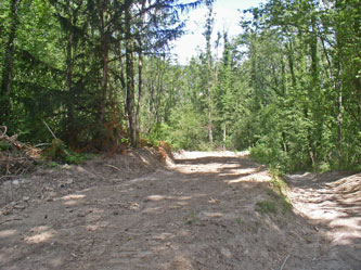
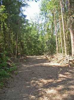
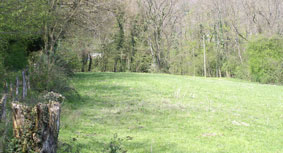
Logging road to the east, after turning back west, with piled logs; end of logging road clearing seen from the old path
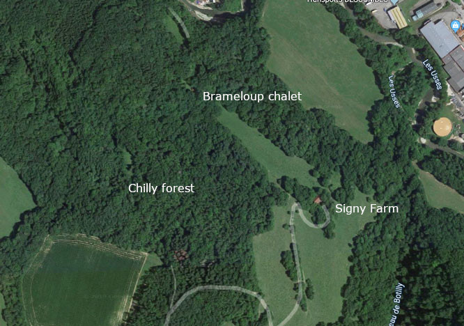
Aerial view of the forest before logging road construction (I am waiting for a view after)
SIGNY
FARM
.
.
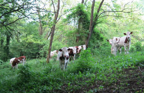
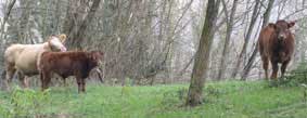
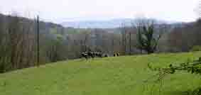
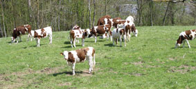 My nearest neighbors are cows. The clanging of their cow-bells competes with the bird songs as the loudest noise at Brameloup
 The chalet is in the middle of the forest, with no other houses around it. The nearest house is the farmhouse and barn at Signy about a kilometer away up the forest path. The chalet was originally built by the farmer for his daughter, but the old farmer has died and the pastures are rented to a farmer with a big farm in the village of Quincy two kilometers up on the plateau. No one lives at Signy now. My nearest neighbors are in fact his cows, whose bells I can hear as they graze in the local pastures.
.
.
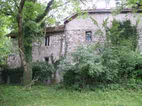
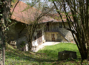
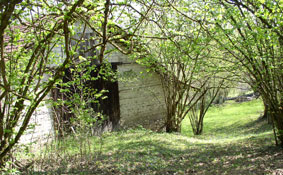
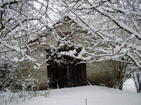
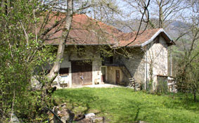 The farmhouse and barn at Signy
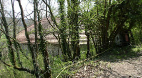
.
.
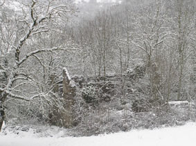
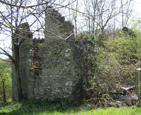 There is a large two-storey barn with an entrance at the upper level, and the ruin of an old house
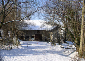
.
.
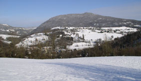
 The farmhouse, the barn and the ruined house in winter
 The farm is surrounded by pastures with lovely views
.
.
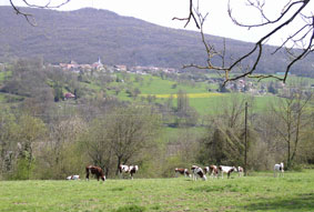
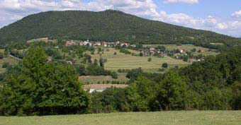
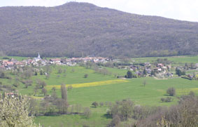
 The village of Musièges is visible in the distance half way up the mountain (center and right photos)
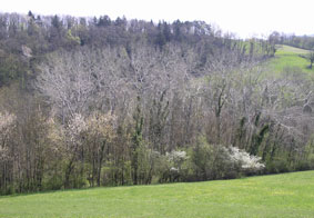
-
.
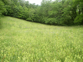
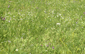
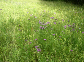
 In the picture on the right, my chalet is barely visible through the trees at the end of the pasture
 Below my property is another small pasture of Signy farm between my land and the path down the hill. In the spring, it is full of wildflowers. The farmer has stopped using it for grazing, so it is gradually being overgrown.
.
.
MUSIÈGES
.
.
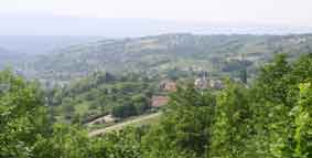
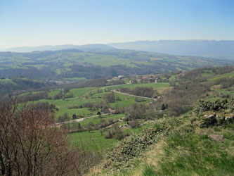
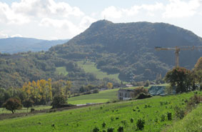
 Musièges in the distance half way up Le Mont, taken from Signy farm
 My local commune is the village of Musièges, with about 300 inhabitants, but it is high on a hill named "Le Mont" (the mountain) on the other side of the Usses River, and I am its only resident on the south side of the river. When the mayor came to help with my water connection a few years ago, it was the first time he had visited this part of his commune. Between Brameloup and Musièges, on the other side of the river, is Les Bonnets, an economic activity zone (a kind of small industrial park) with a sawmill, agricultural store, warehouses and a Fromagerie (cheese factory). At least when I buy butter and cheeses at the local supermarket, like Tomme de Savoie, rebluchon or raclette, I know that it was made locally, probably with milk from the cows whose bells I hear, very ecological with minimal transport. My eggs come from Seyssel, another town on the Rhone River about 15 km away.
.
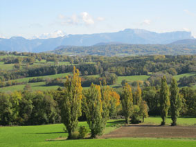
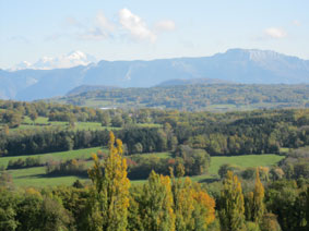
 Views of Musièges and of the Genevois valley looking towards Geneva from the top of Le Mont
 Towards Frangy 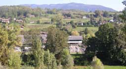 Usses River
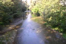
FRANGY
The closest community to Brameloup is in fact the large village of Frangy, with about 1,800 residents. I am just at its limit, with part of my land in that municipality.
Frangy Church and War Memorial 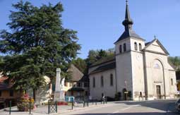
Frangy is just a 10 minute walk down my road, through a tunnel under the national highway bypass, and across a suspension footbridge, La Passerelle de Brameloup, over the Usses River.
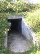 Tunnel
 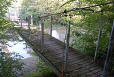 Footbridge
 Suspension bridge 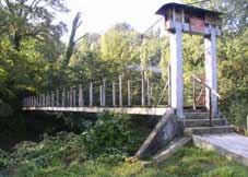 Bridge from Frangy
Frangy is a cantonal centre, with a gendarmerie and fire station, doctors and dentist, schools and multipurpose hall, bank, pharmacy, a variety of stores and a supermarket.
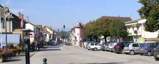 Centre of Frangy
 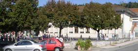 School
 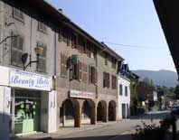 Shops
Shops As with all the villages in our area, old houses are being renovated and small apartment blocks being built as more people move in, so it is not looking as run-down as when I first moved here. The city of Annecy is less than a half hour away, and is developing in our direction, with a giant shopping centre and new hospital complex only 15 minutes from Frangy. A new superhighway between Geneva and Annecy was recently completed, which has improved access to the region, bringing more people.
I am glad that planning restrictions limit new construction to existing villages, and that my side of the river is zoned for nature conservation with no building permitted. My green island of calm is reasonably secure.
CHAUMONT
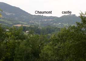
Above Frangy on a rocky outcrop on the side of the mountain opposite to my chalet is the village of Chaumont, higher than my chalet and in the middle of my view across the valley. Chaumont is dominated by the remains of a medieval castle, built in 1124 by the Counts of Geneva. It was a strategic site of great economic and military importance, at the intersection of two great routes in the Middle Ages between Geneva and Lyon, and between Genoa and Franche-Comté. The castle was razed in 1616 (along with a similar castle at Clermont 15 km south of my chalet) by Henry 1st of Genevois-Nemours, cousin of the Duke of Savoy, to prevent the region from having the capacity to resist his domination.
Chaumont from my chalet 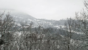 Chaumont from the chalet in winter
 Village 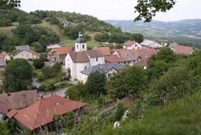 Castle from village
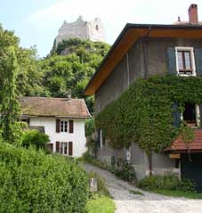
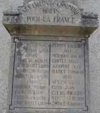
One of my wife Martine's ancestors came from Chaumont. François-Antoine Curtet (1763-1830) was the son of Christophe Curtet (b. 1707), the notary public of Chaumont. He trained as a surgeon in Turin, joined the French army of the North in 1794, and after being assigned to a hospital in Brussels, settled there in 1797, where he later helped to re-establish the Medical School after the Napoleonic Wars. His daughter Cécile married Adolphe Quetelet (1796-1874), a famous scientist, permanent secretary of the Belgian Royal Academy, founder of the Brussels Observatory and the meteorological service, and a key figure in the development of the science of statistics. Martine is the great-great-great granddaughter of Quetelet. There were still Curtets living in Chaumont in World War I, as a Felix Curtet is listed on the war memorial (d.1917).
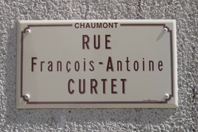
The municipality has recently named the street between the Mairie (city hall) and the church "Rue François-Antoine CURTET" in honour of my wife's ancestor, born in the village in 1763. A portrait of Curtet hung in my mother-in-law's home, and I gave a reproduction to the Mairie.
Mairie (city hall) 
.
.
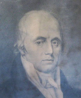
François-Antoine Curtet, born in Chaumont in 1763
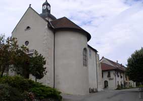
Of the first church in Chaumont built by Agnès of Chalon in 1308, only the Gothic choir and the door to the bell tower remain.
 Gothic door to bell tower
 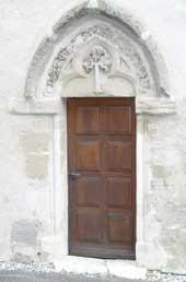 Church
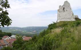
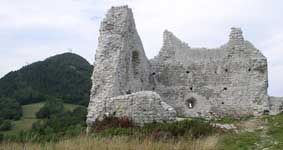
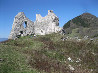
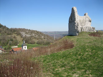
 The village is nestled in a dip in the mountain behind the castle, between it and La Vuache mountain to the north, which is an extension of the Jura mountains, cut off from them by the Rhone River. The castle covered all of a high rocky outcrop, with only one steep trail up. Of the ruins of the castle of Chaumont, only the foundations and part of the keep remain standing, but its dominant position is impressive. Most of the stones were carried off to construct buildings elsewhere.
.
.
 Remains of the keep or donjon, the central tower and last fortification
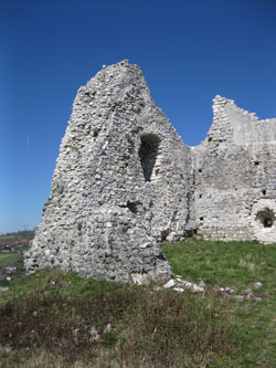
.
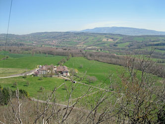
 The keep, with the steeple of the church in Chaumont visible behind it
 The view from the Chaumont castle ruins shows what a dominant position it had.
.
.
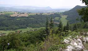
 View to the north and east, with the Alps in the background
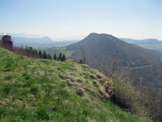
.
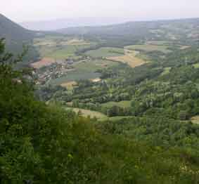
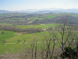
 Looking south towards "Le Mont" and southwest across the Usses Valley towards Frangy and my chalet
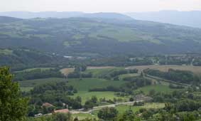
.
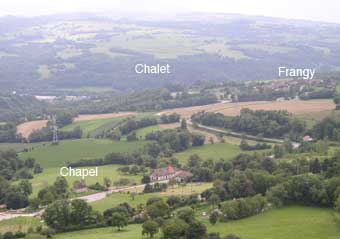
Looking south from Chaumont over the valley of the Usses River, my chalet is in the middle of the forested area beyond the river, and Frangy is to the right. The Saint-Jean Chapel is to the bottom left.
Below Chaumont is the little Saint-Jean chapel used by the inhabitants of Chaumont since 1198. It was burned by the Bernese in 1590 when they invaded the region and established Protestantism, was reconstructed, and last restored in 1826.
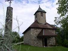
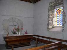 Saint-Jean chapel
THE
ROAD TO FRANGY
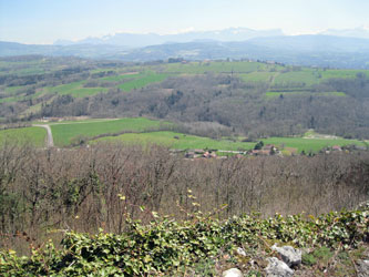
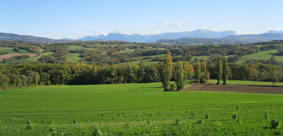 The road from Geneva to the chalet through the Genevois region passes through the villages of St.Jean-en-Genevois, Viry, Mont-Sion, Jonzier-Epagny, Le Malpas (part of Chaumont) and Frangy. It is about 40 km, mostly through rolling countryside with green fields and hills, passing along the lower slopes of La Vuache (a mountain extension of the Jura Mountains), crossing a pass at Le Malpas below Chaumont between La Vuache and Le Mont, and descending into the Valley of Les Usses River to Frangy. In some places the view extends to the Alps and Mont-Blanc, and returning to Geneva there are lovely views of the whole Geneva basin.
View near La Malpas
.
.
 (left) Fields and hills near Le Malpas; (center) the other side of Le Mont facing the Genevois; (right) the Alps with Mont-Blanc behind on the left