At the end of March 2013, I went to Bulgaria for 10 days to visit my
brother Greg, his wife Emi, and Greggie, Joyce and Mina. After a night in
Sofia, we went to Husarya, near Plovdiv, which used to be the ancient
Roman town of Diocletianopolis from the 4th century AD. Its mineral hot
springs have attracted visitors for many centuries. It was one of the few
Roman towns build for tourism rather than military purposes. On the way
back to Sofia, we stopped to visit Thracian sites near Starosel which were
much older (5th-4th century BC). I always liked archaeology, and studied
it at university, so the sites were of great interest. After another night
in Sofia, we went to the village of Krupnik in the south near Blagoevgrad,
where Emi's parents live and Greg has a house, to visit with family and
friends.
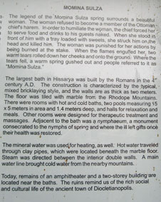
HISARYA
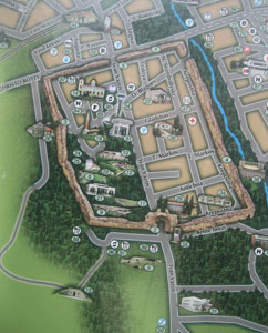
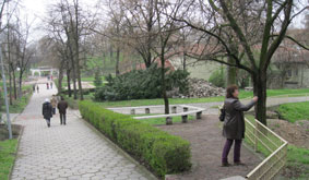
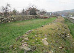
Much of the old Roman wall around the center of Hisarya still exists, as
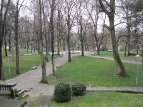
shown on the map below. The area around the main springs is mostly park
and archaeological sites. We visited the mineral hot springs and a local
museum, and I took some time to walk all around the Roman wall.
 .
.  .
. 
Map of the center of Hisarya showing the Roman wall and main gate
at bottom center; the park between the mineral springs
 .
.  .
. 
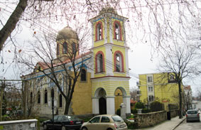
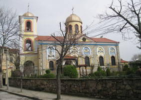
The Orthodox Church; our hotel across the street
 .
.  .
. 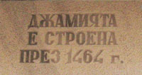
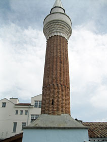
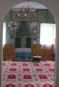
The minaret and its tiny mosque built in 1464
 .
.  .
. 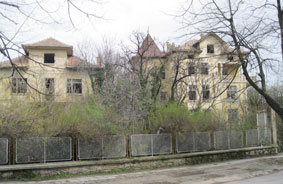
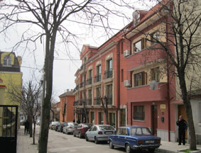
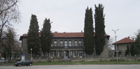
The town amphitheatre; an old vacation center; abandoned homes
(many families have emigrated, and heirs cannot decide on inherited
properties)
 .
.  .
. 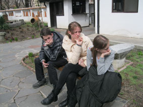
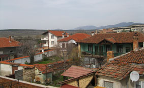
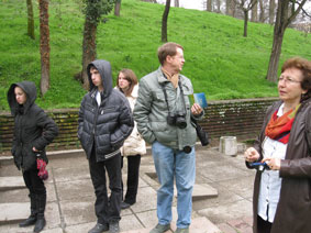
Rooftops in Hisarya; the Roman wall behind the houses; teenagers'
response to a museum visit
The mineral springs
 .
. 
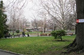
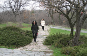
Walking down through the park to the springs
 .
.  .
. 
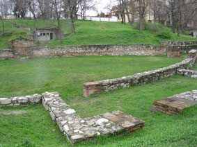
A Roman public building for a library and other activities near the
baths
 .
. 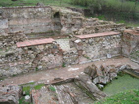 .
. 
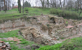
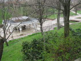
The Roman baths
 .
.  .
. 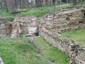
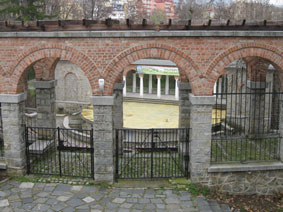
Roman ruins and the modern springs where people line up to fill
their water bottles
 .
.  .
. 
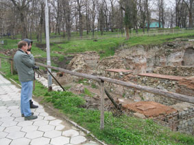
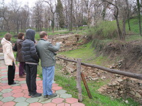
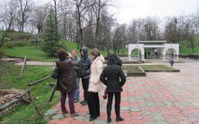
Remains of the Roman Amphitheatre; the modern springs; Joyce,
Greggie, Mina, Greg and Emi at the springs
 .
.  .
. 
The story of the springs; springs and Roman ruins
 .
. 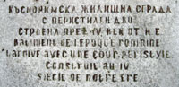
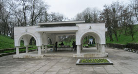
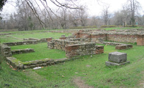
A late Roman building with peristyle; plaque in Bulgarian and
French
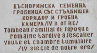
Roman tomb
 .
.  .
. 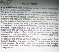
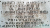
A short walk outside the walled town led to a Roman tomb from the
second half of the 4th century AD
 .
. 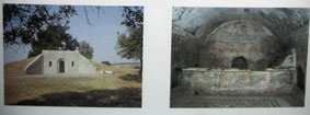
The plaque describing the tomb, and pictures of the exterior and
interior
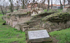
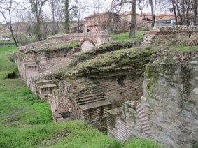
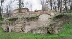
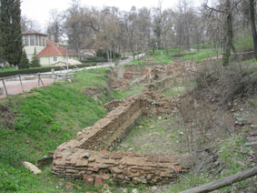
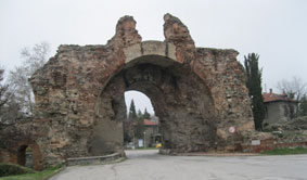
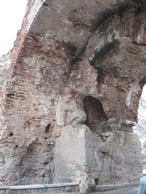
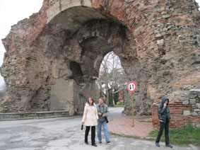
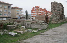
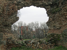
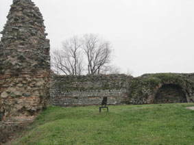
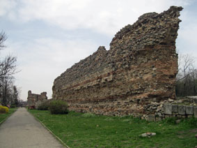
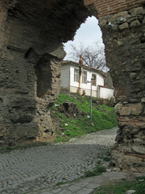
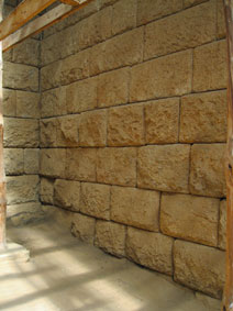
Roman walls of Hisarya (4th century AD)
 .
.  .
. 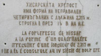
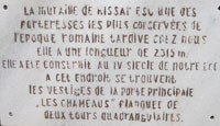
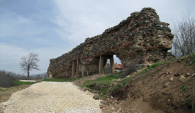
The "camel" gate, or main gate to the town, which had square towers
on either side. The walls extend for 2,315 meters and form an irregular
rectangle.
 .
.  .
. 
Details of the main gate, with a staircase up to the tower
 .
.  .
. 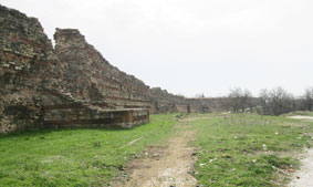
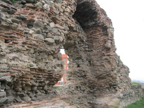
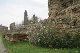
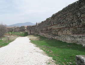
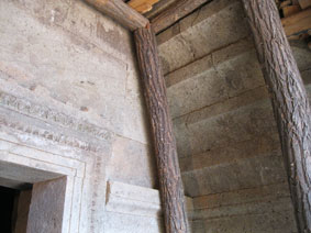
The double wall on the North side, with projecting square
towers
 .
.  .
. 
New buildings beyond the walled town
 .
.  .
. 
The walls and square towers now form a green belt around the town
 .
.  .
. 
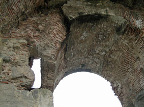
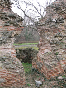
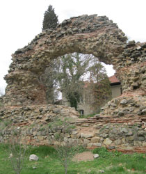
Tunnels through the walls led to square towers; carved stone
lintels
 .
.  .
. 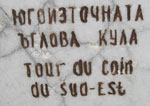
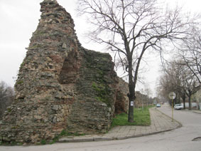
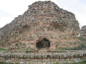
The southeast corner tower
 .
.  .
. 
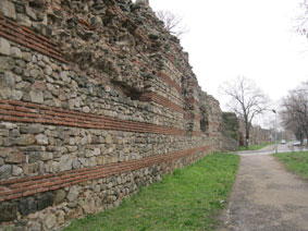
The southern wall
 .
.  .
. 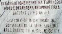
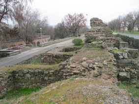
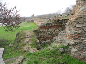
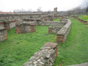
The wall beyond the main gate, with barracks behind it for the
military garrison
 .
.  .
. 
Northern part of the eastern wall
STAROSEL
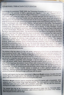
There are many tumuli from Thracian times on the plains around Starosel,
but the temple in the one we visited was only discovered in 2000. It dates
from the 5th-4th century BC and is beautifully preserved, retaining even
some of the original colouring on its carved decorations. The precision of
the stonework is amazing.
 .
.  .
. 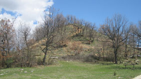
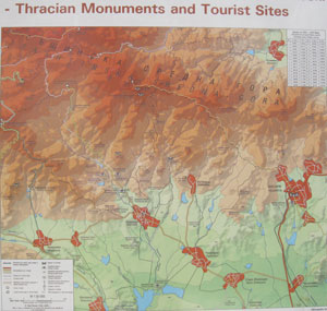
Map of the area around Starosel with many Thracian monuments; the
tumulus (artificial hill) in which the cult center was found
 .
.  .
. 
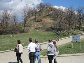
Emi and Greg, and the whole family on the path to the Thracian cult
center; the view from the tumulus
 .
.  .
. 
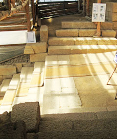
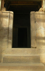
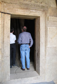
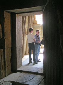
The entrance to the temple, showing the excellent stonework
 .
.  .
.  .
. 
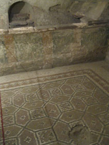
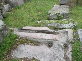
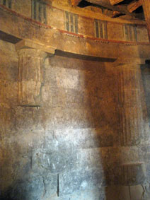
The outer and inner doors to the temple were of stone; the inner
sanctuary was a perfect circle over 5 meters in diameter, with
half-columns and painted decorations
 .
. 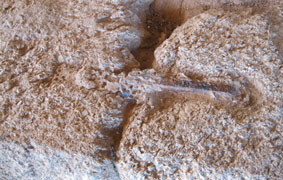
The stone doors had greased rollers in carved channels; stones were
held together with iron bars set in lead
 .
. 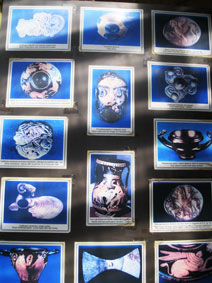
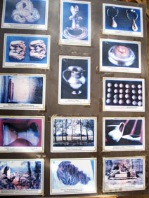
The treasures found in the cult center are now in a museum
Grave of a Thracian ruler
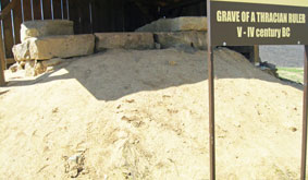 .
. 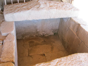
Near the temple was the grave of a Thracian ruler of the 5th-4th
century BC
 .
. 
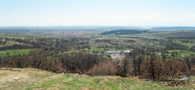
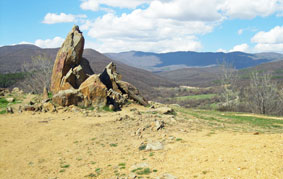
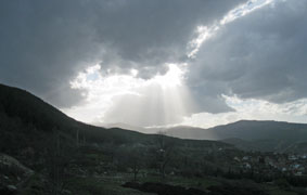
There were beautiful views from the temple site
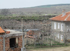
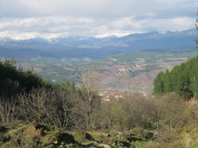
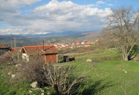
KRUPNIK
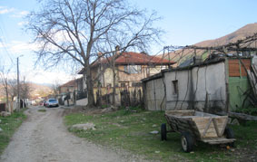
My brother Greg and his wife Emi built a house in Emi's village next to her
parents' home, where they have many fruit trees, grow wonderful vegetables,
and have an abundant supply of eggs, putting up many preserves for the
winter. We eat very well there.
 .
. 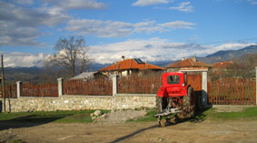
The village street with Greg and Emi's house behind the tree; the
back of their garden with snow-covered mountains beyond
 .
.  .
.
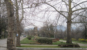
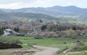
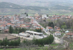
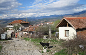
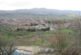
The village of Krupnik; the village centre with stadium and Orthodox
Church in gold
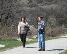
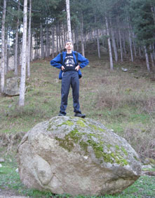
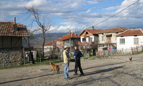
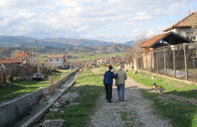
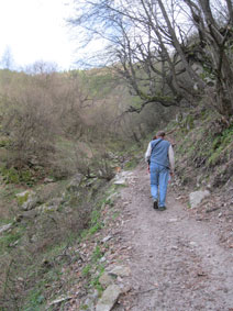
While we were in the village of Krupnik, enjoying the early spring with
fruit trees and flowers starting to bloom (late this year), we went for a
walk through the upper part of the village, which is up on a hillside, and
up along a rushing stream into the forest above, with views of the
snow-covered mountains across the valley. On another day, we hiked up
another path with spectacular views of the village and the valley.
 .
.  .
. 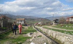
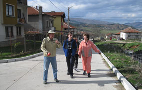
Walking up the village of Krupnik
 .
.  .
. 
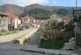
Views in the village
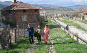 .
.  .
. 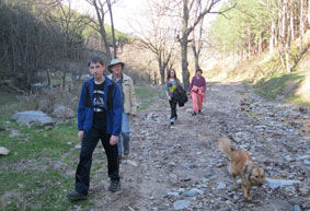
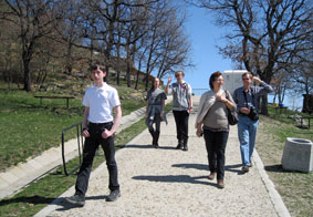
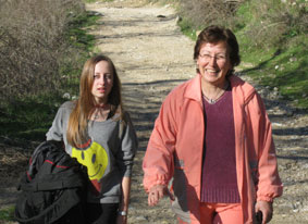
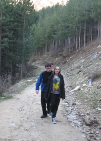
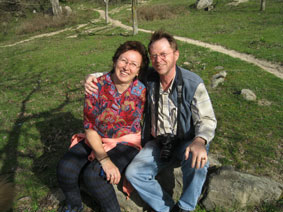
Greggie, Joyce and Emi walking up into the forest; Joyce and Emi;
Greggie, Greg, Joyce and Emi in the forest
 .
.  .
.  .
. 
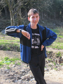
Gregory Dahl (Greggie), and with his twin sister Joyce
 .
.  .
. 
Greggie, Joyce and Emi; views from the forest over the village
 .
.  .
. 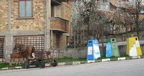
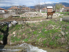
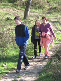
Greg and Greggie in the village; a horse-drawn wagon with mare and
foal, and 3 recycling bins in the village
 .
.  .
. 
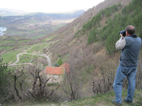
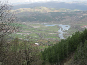
Looking down on the village of Krupnik; the seismic observatory and
the valley beyond
 .
.  .
. 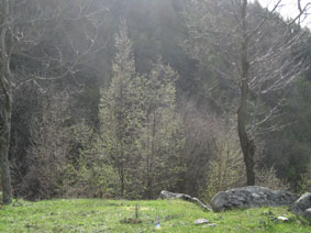
The trail up; Emi and Greg in a mountain pasture; the first buds of
spring
 .
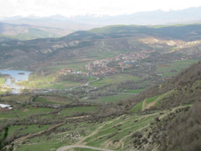
. 
Valley bottom with the river; sun and clouds over Krupnik